Back

Bhitarkanika


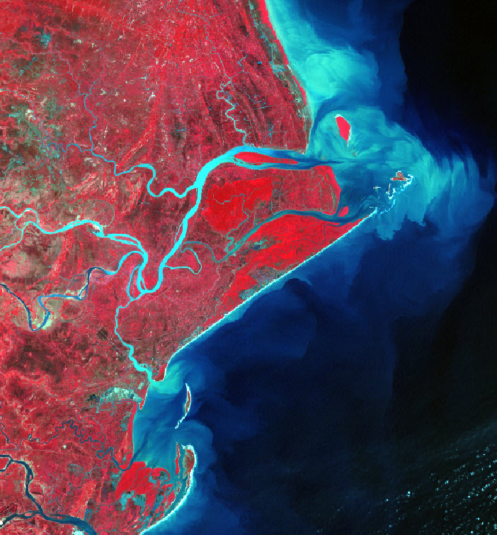
This is Landsat TM image of Coastal Orissa showing the famous Bhitarkanika Mangrove forest. The image also clearly shows the Gahirmata Beach (known for turtle nesting), Agriculture land, Plantation, Dhamra River, Islands and spits. Meandering streams with ox-bow lakes are also visible.

Page last updated: 16 October 2012, 11:46

IMPORTANT LINKS

indian institute of remote sensing, indian space research organisation

Department of Space, Government of India

4, Kalidas Road, Dehradun - 248 001 (India)

Tel: + 91 -135 - 2524399 Fax:+ 91 -135 - 2741987

Training & Academic

admissions[at]iirs[dot]gov[dot]in

ppeg[at]iirs[dot]gov[dot]in

dean[at]iirs[dot]gov[dot]in

Outreach & Distance Learning

dlp[at]iirs[dot]gov[dot]in

elearning[at]iirs[dot]gov[dot]in

Director IIRS

director[at]iirs[dot]gov[dot]in

space centers in india

visitors

national portal of india

Image of National Portal Of India