Profile of Scientist and Scientific Staff

Geoinformatics Department (GID) is one of the youngest technological departments, set-up in 1996 with the collaboration of University of Twente, Faculty of Geoinformation Science & earth Observation (ITC), The Netherlands, to offer core technological courses in the field of Geo-information Science. GID department imparts training, educarion & research in the field of GIS, DBMS, spatial analysis and modelling, Transportation GIS, 3D GIS, Spatial Data Mining, Health GIS and development of software tools using FOSS4G.
Vision of Geoinformatics Department
Achieving Excellence in Geo information Science for societal benefits through knowledge transfer while building core competence in frontier areas
Regular Courses:
- M.Sc in Geoinformation Science & Earth Observations (Specialisation in Geoinformatics) IIRS-ITC JEP
- P.G. Diploma in Geoinformation Science & Earth Observations IIRS-ITC JEP
- M.Tech in RS & GIS (Specialisation in Geoinformatics)
- P.G. Diploma Course in Remote Sensing & GIS of CSSTEAP (UN)
- NNRMS Course for University Faculty
- ITEC Course
Organised Special Courses:
- Indian Air Force
- West Bengal Forest Department
- NCERT
- ISRO/DOS Officials
- Indian Bureau of Mines, Ministry of Mines
- ISPRS Summer School
- Department of Science and Technology
- National Institute of Electronics & Information Technology (NIELIT-DeITY)
- Ministry of AYUSH
- Indian Council of Medical Research
Project Supervision:
Department has been providing guidance during project work to the students (Internal & External) of following courses
- M.Tech/M.Sc./PGD courses in Geoinformatics of IIRS & CSSTEAP
- Participants of NNRMS/ITEC courses of in Geoinformatics
- External students/Summer Tranees (Indian & Foreigner) of M.Sc./M. Tech/MCA/B.Tech courses
Major Research Area
- Distributed GIS & Enterprise GIS
- 3D GIS and CityGML
- Spatio-temporal modeling
- Health GIS
- Advanced geo-statisitics
- Transportation GIS
- Modeling in High performance computing environment
- OGC standards and interoperability
- Mobile and Location Based Services (LBS)
- Handling of multi-dimensional geo-spatial databases (SOLAP) & Analytics
- Geo-webservices and online geo-processing
- Spatial decision support system
- Wireless sensor network based real time road traffic monitoring
- Computational Geometry
- Big data analytics
- Semantic Web using Ontology
- Spatial Data Mining
- Crowdsourcing & Citizen science
- Sensor web enablement
- Software development in FOSS4G
- IoT (Internet of Things)
Major Contributions
- Geospatial solutions for societal needs (Swacch Bharat, Road GIS, Health GIS etc.)
- IIRS-ITC Linkage under Joint Education Programme (JEP)
- Indian Bio-resource Information Network
- ISPRS Summer School
- Capacity building requirements for different Ministries

Instruments
- High-sensitivity 48 channel GPS devices
- Digital Video Camera Recorder
- Digital multimeter
- Digital Storage Oscilloscopes
- HD Video recording Camera
Hardware/Software
- High end work stations and desktops
- ILWIS, ERDAS Imagine, ArcGIS, ENVI, Quantum GIS, IGIS, etc.
Laboratories
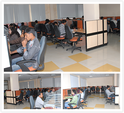
- Common computer lab for conducting training programmes
- Research computer lab for M.Sc & M.Tech students in research phase
- JRF computer laboratory
Phone : +91-135-2524124
Email : gid[at]iirs[dot]gov[dot]in
Address : 4, Kalidas Road, Dehradun- 248001 India


