Atmospheric CO 2 Measurement Network
A network of atmospheric CO
2
measurement observatories is set-up by the Institute to quantify temporal (diurnal, seasonal and intra/inter-annual) and spatial CO
2
variability and to understand CO
2
source and sink relationships. The four sites – Dehradun (Uttarakhand), Nainital (Uttarakhand), Gadanki (Andhra Pradesh), and Mount Abu (Rajasthan) – are presently operational. Highly precise (accuracy + 3 ppm) CO
2
sensors along with data loggers are installed at these sites. Two more sites are planned at Sriharikota (Andhra Pradesh) and in NE region.
Observatory for Aerosol Climatology
An aerosol observatory is set-up in IIRS campus to study the optical and physical properties of aerosols in and around Dehradun. A number of highly precise instruments, such as multi-wavelength solar radiometer (MWR), aethalometer, high volume air sampler, sunphotometer and ozonometer, are being used for the measurements. The Institute has also participated in a number of land and sea/ocean campaigns to study aerosol properties.

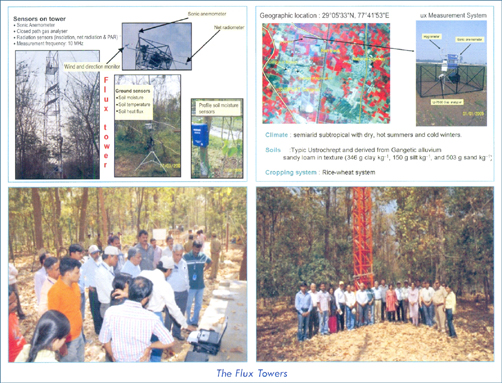
Flux Towers for Measuring Energy, Water Vapour and CO 2 Exchanges
The Institute has set-up four flux towers at Haldwani (Uttarakhand), Barkot (Uttarakhand), Meerut (Uttar Pradesh) and Betul (Madhya Pradesh) for measurement and modelling of the net carbon flux in agriculture and forest ecosystems using eddy covariance techniques, satellite remote sensing data and models. These flux towers are equipped with state-of-art, high-precision instruments to measure energy, water vapor and CO
2
exchanges. A nationwide network of 15 such flux towers is planned in different ecological regions of the country within the framework of National Carbon Project under the ISRO-Geosphere Biosphere Programme.

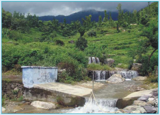
Field Observatory for Soil Erosion and Runoff Assessment
An instrumented field observatory is set-up in Sitla rao watershed (Dehradun District, Uttarakhand) to study soil-hydrological processes and to carry out process-based modelling of runoff and erosion in the Himalayan landscape. Field-based measurements are being made using automatic weather stations, self-recording rain-gauges, automatic stage level runoff (discharge) recorder, and portable suspended solid analyser. It is also a study site for various training and education programmes of the Institute.

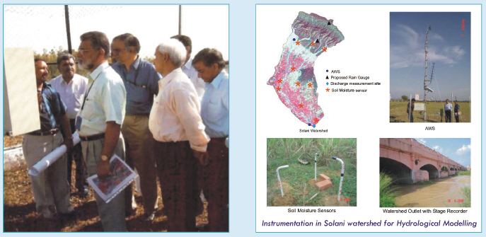
Field Observatory for Hydrological Modelling
This instrumented field observatory, set-up in Solani watershed (covering parts of Uttarakhand and Uttar Pradesh) in collaboration with National Institute of Hydrology (NIH), is meant for generating spatial and temporal ground-based data on hydrological variables. The ground-measured hydrological variables are used along with RS data-derived inputs for hydrological modelling. The watershed is equipped with automatic weather stations, soil moisture sensors and an automatic discharge gauge site. It is also a study site for various training and education programmes of the Institute.


