|
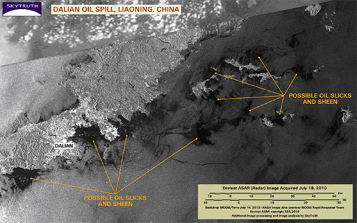
Sometime last week, two pipelines in the port city of Dalian, China, exploded and burned, and a large quantity of oil was released into the Yellow Sea. The oil spill is spreading rapidly and there are already talks about a heavy and long-term environmental impact. Officials report that 165 square miles of ocean was covered with oil. This Envisat radar satellite image appears to show patchy oil slicks spread out over a large area along the coast and islands near Dalian. China Central Television reported that the spill was estimated at about 400,000 gallons. Aquaculture is a huge business in China - Greenpeace estimates that 10,000 shellfish farms have been affected.
Envisat ASAR radar image (black-and-white) taken July 18, 2010 Source: http://blog.skytruth.org/2010/07/dalian-oil-spill-china.html |